
- Cloud
- 48%
- Rebuilt
- 81%
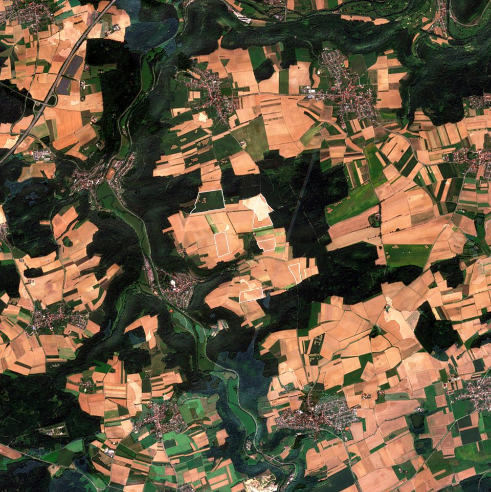
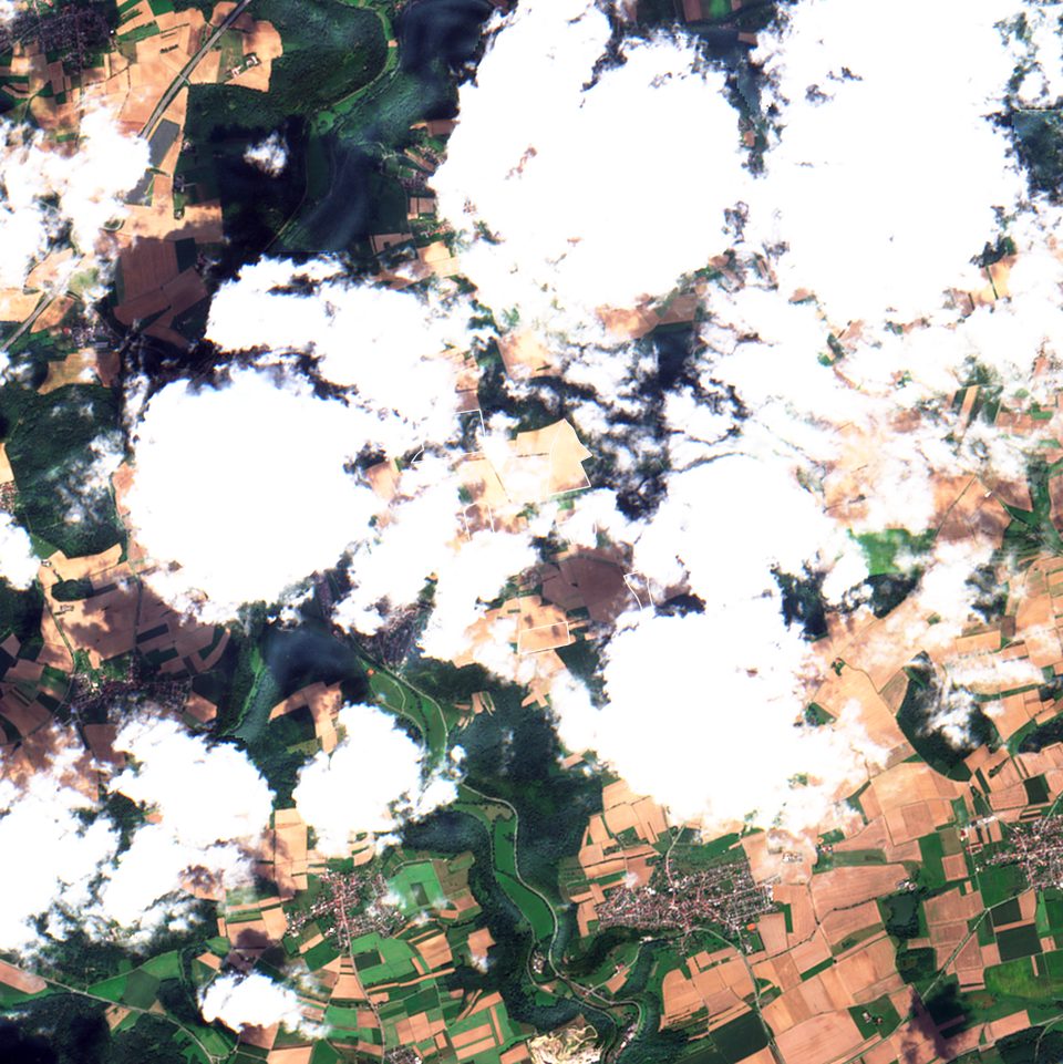
Contains modified Copernicus Sentinel data 2025
Validation
Share of real cloudy field-days where the Fusion field NDVI is within ±0.10 of the next clear Sentinel-2 acquisition. Test fields were drawn and frozen before scoring and never used in training.
| Product | Test set | Within ±0.10 | Result against the measurement ceiling |
|---|---|---|---|
| Final imageGermany-wide | 100 fields across Germany in two independent cohorts (91.8% and 94.8%) | 93.3% | |
| Final imagesouth-west Germany | 150 fields in three cohorts (94.5 / 93.2 / 93.6%) | 93.8% | |
| Same-day imageGermany-wide | 50 fields across Germany | 85.4% | |
| Same-day imagesouth-west Germany | 150 fields in three cohorts (89.7 / 88.1 / 89.2%) | 89.0% | |
| Final imageper pixel | Pixel NDVI within ±0.10, 50 fields in south-west Germany | 91.2% | |
| Referencemeasurement ceiling | How often two clear Sentinel-2 acquisitions 1–5 days apart agree on field NDVI | 95.0% |
Each cohort is 50 German fields of 5–10 ha that the models never saw, drawn and frozen before testing. The south-west cohorts come from the same region as the training fields; the Germany-wide cohort is lower, mainly because intensively mown grassland is often cut between two clear images. The black tick marks the Sentinel-2 repeat ceiling. Winter (October–March) is harder, about 75–77%.
Cloud detection
OmniCloudMask on every acquisition, combined with the Sentinel-2 scene classification and a haze screen. Cloud shadow and thin haze are treated as cloud.
Reconstruction
Hidden pixels are rebuilt from clear Sentinel-2 looks before and after the date, Landsat 8/9 where it adds evidence, and a temporal model trained on German arable and grassland fields.
Uncertainty
Field values carry a 95% bound calibrated on real cloudy days. Each pixel is flagged as observed, rebuilt with clear evidence within 12 days on both sides, or rebuilt with weaker evidence.
API
Base URL https://api.fusion.spacenus.com. Requests are authenticated with an x-api-key header. Request a key.
Endpoints
- POST
/v1/jobsSubmit field polygons and a date range. Returns a job id. - GET
/v1/jobs/{job_id}Job status. When done, signed download links for every output. - GET
/v1/healthService health, no key needed.
Request body
fieldsGeoJSON- FeatureCollection of Polygon or MultiPolygon in WGS84, up to 200 fields
start, enddate- Season window, ISO dates, at most 366 days
tiersstring[]- Optional. causal (same-day) and settled (final); both by default
Outputs per job
bands/<date>.tif- 10 bands B2–B12, reflectance × 10000
rgb/<date>.tif- True colour for viewing
indices/<date>.tif- NDVI, GNDVI, NDRE, NDMI, EVI, SAVI, LAI
certified/<date>.tif- Per-pixel evidence class 0 / 1 / 2
ndvi_err95/<date>.tif- Per-pixel 95% NDVI bound
ndvi_daily.csv- Per field and day: NDVI, NDRE, NDMI, 95% bound, source
GeoTIFFs are in the field's UTM zone at 10 m. Same-day results are available once Sentinel-2 delivers; final results follow when the next clear acquisition arrives.
curl -X POST https://api.fusion.spacenus.com/v1/jobs \
  -H "x-api-key: $FUSION_API_KEY" \
  -H "content-type: application/json" \
  -d '{
    "start": "2025-04-01",
    "end": "2025-09-30",
    "fields": {
      "type": "FeatureCollection",
      "features": [ ... ]
    }
  }'